Go to Help Summary Go to FAQ Summary
Menu bar/Tools/Floodable Length
____________________________________________________________________________________________________________________
Purpose:
Automatically calculates current ship’s Floodable Length according to a given stability criterion and a permeability range.
As this calculation usually doesn’t take tanks into account, a confirmation box pops up if tanks are encountered in the current model.
At last, this calculation will be refused as long as no freeboard line is present in the model to allow calculating the critical floatations network
Inputs:
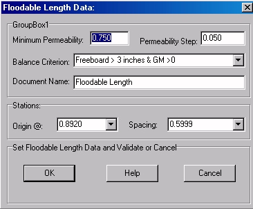
The following dialog box pops up when the function is selected:
The ‘Minimum Permeability’ input field allows entering the minimum permeability of the calculation range.
The ‘Permeability Step’ input field allows entering the permeability step of the calculation range, a permeability of 1 being assumed to be the maximum.
The ‘Balance Criterion’ selector allows selecting according to which criterion the Floodable Length must be calculated. Only 2 criteria are available for the moment (STC criteria will be accepted in the future):
- ‘Freeboard > 3 inches and GM > 0’.
- ‘Freeboard > 3 inches’.
- ‘GM > 0’.
The ‘Stations’ frame allows defining Floodable Length’s station grid to use for the reports, being assumed that the stations are equidistant and automatically distributed along ship’s length according to the entered origin and spacing:
- The ‘Origin @’ input field allows entering the position of a station.
- The ‘Spacing’ input field allows entering the station spacing.
At last, when these floatation data are set, the input field located in the ‘Document Name’ frame will allow naming the 2D folder in which the resulting reports will be created created in the 2D browser.
The [OK] button can be clicked for calculating the Floodable Length according to the current data.
The [Help] button allows displaying the online help (Internet access necessary).
The [Cancel] button allows cancelling the calculation.
Outputs:
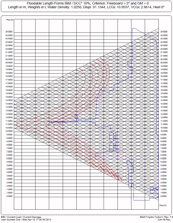
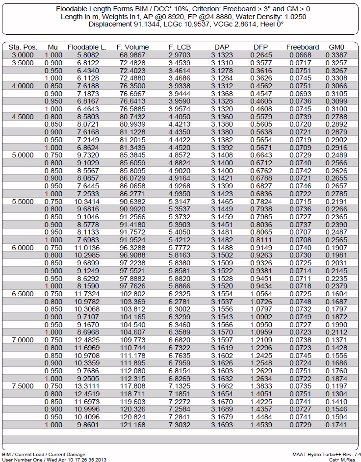
After clicking on the [OK] button, a 2D folder is created, containing the hydrostatic curves and tables corresponding to the entered data and displayed in the [2D] tab.
The following reports are automatically created:
Limitations:
At least one freeboard line (i.e. a line set in the ‘Freeboard Layer’ declared on [Ship] tab’s [Hydro] page) is necessary to allow calculating the critical floatations.
Calculation’s duration mainly depends on the number of stations.
Typical use:
Calculating ship’s Floodable Length allowing to preset ship’s transverse bulkheads.
Example:
Open the ‘Example Ship.m2a’ file and double click on ‘Damage 100% Supply’ in the 3D browser to select this virtual ship:
Select '/Tools/Floodable Length' in the menu bar.
Click on the [OK] button directly to start the calculation.


